 Return
hebergement collectif
Return
hebergement collectif
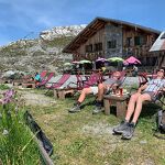
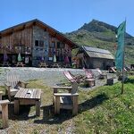
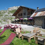
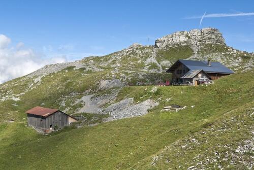
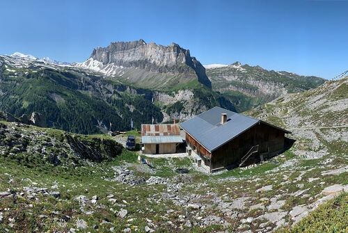
Grenairon mountain refuge
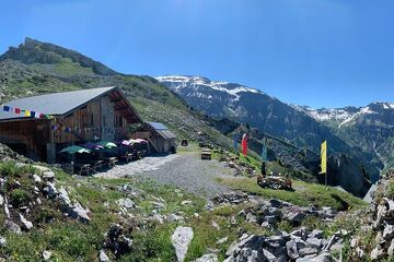
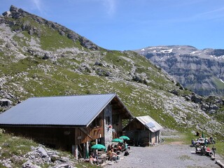
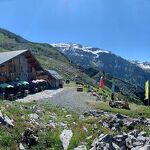
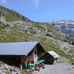
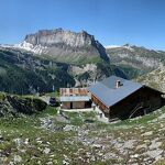
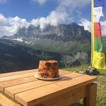


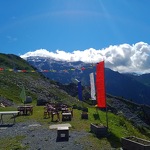
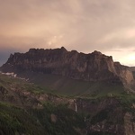
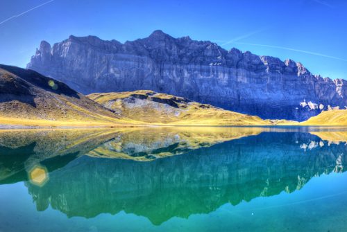
Enjoy 360° panoramic views of Mont Buet, the valley of Anterne and the majestic Fiz mountain range with Mont Blanc in the background. The villages of Samoëns and Sixt and the Giffre Valley can be seen below.
Description
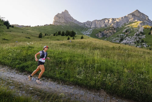
It is a stage on itinerant tours or summits (Tour des Fiz, tour du Ruan, Mont Buet, Cheval Blanc, ...).
With family or friends, the Grenairon refuge is accessible to everyone, for the day or for an evening.
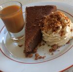
After the effort comes comfort! The caretakers offer you a menu of homemade dishes and desserts to perk you up.
To discover: La Chèvrerie de l'Alpage du Grenairon offers these cheeses made on site.
The refuge has a room open in winter.
Equipment
-
 Terrace
-
Restaurant
-
Coach parking
-
Waste management
-
Photovoltaic panel

Complément accueil
Catering: Fondant with chestnut cream, stuffing.
Comfort
-
Shower
Environments
-
Mountain location

Rates
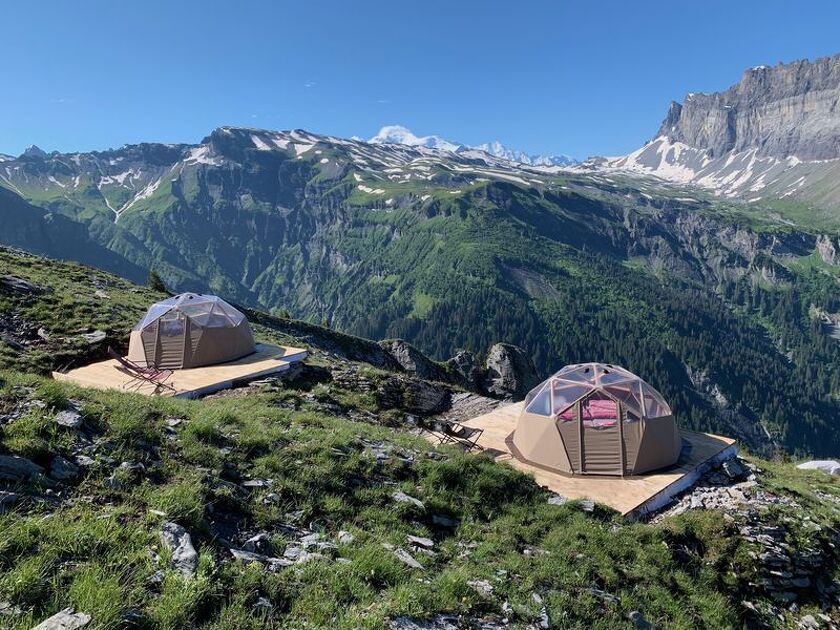
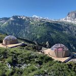
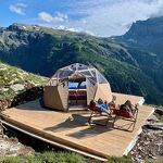
Night: 150 € (Half-board in a Geodesic Dome "Head in the stars
(price for 2 people on half-board basis))
Half board (pp): 50 €
Half-board (child): 37 €.
Free entry for children < 5 years.
Sheet rental: €4
Shower: €3.50.
Payment methods
-
Bank/credit card
-
Travellers Cheque
-
Cash


Bons plans
Summits: Le Mont Buet (3100m above sea level / 4h30 / 1150m drop) - Le Cheval Blanc (2831m above sea level / 4h / 900m drop)
Day hike: Les Frêtes du Grenier (1h / 400m drop), Mont Buet, Cheval Blanc, map of Lake Buet (2543m altitude / 2h30 / 600m drop), La Cathédrale (2531m altitude / 1h30 / 550m of altitude difference).
Opening period
From 14/06 to 21/09/2025.
Languages spoken
-
English
-
French


Adapted tourism
-
Not accessible in a wheelchair
Location
Closest village or station: Sixt-Fer-à-Cheval - Salvagny
Walking time from the nearest car park: 3 hours of walking
Access possible and authorized by 4x4
Access possible by footpath: Departure from the Nant Sec bridge car park. Take the path on the left of the car park, after a slightly steep start, follow the path on your right which runs along the Nant Sec torrent. The path crosses a first torrent, joins an intersection (sign altitude 1400m). Continue on the right towards the Grenairon refuge.
Coach parking.
- IGN maps: 3530 ET - 3630 OT
Animals
Pets allowed : No
Thèmes
-
Tips : Summits: Le Mont Buet (3100m above sea level / 4h30 / 1150m drop) - Le Cheval Blanc (2831m above sea level / 4h / 900m drop)
Day hike: Les Frêtes du Grenier (1h / 400m drop), Mont Buet, Cheval Blanc, map of Lake Buet (2543m altitude / 2h30 / 600m drop), La Cathédrale (2531m altitude / 1h30 / 550m of altitude difference).


-
 randonnee
Hiking to the Grenairon refuge
Discover the Grenairon Refuge and its beautiful views over the Fiz mountains and the Anterne vall...
- Distance 12.5km
- Durée 05h30
- Difficulté Difficile
- Dénivelé positif 1078m
-
 randonnee
Hike: Le Tour des Fiz
Itinerant circuit from refuge to refuge around the Fiz chain between the Giffre valley and Mont-B...
-
randonnee
Hike: Le Tour des Fiz
Itinerant circuit from refuge to refuge around the Fiz chain between the Giffre valley and Mont-B...
-
 randonnee
Tour des Fiz: Tour of 7 refuges in 2...
A trail running ahead? Get ready with this 50km course and almost 3800m EG!
- Distance 50km
- Difficulté Très difficile
- Dénivelé positif 3850m
-
 randonnee
Tour des Fiz: Tour of 6 refuges in 3...
Experience the Tour des Fiz adventure through the most technical sections!
- Distance 50km
- Difficulté Difficile
- Dénivelé positif 3800m