 Return
randonnee
Return
randonnee
Hiking to the Grenairon refuge
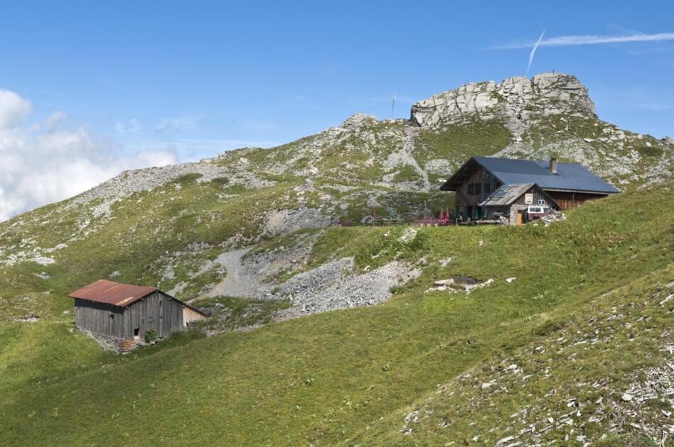
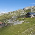
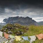

Discover the Grenairon Refuge and its beautiful views over the Fiz mountains and the Anterne valley. The refuge is an important stopping point for hikers on their way to the top of Mont Buet (3,100 metres), the highest mountain of Sixt-Fer-à-Cheval.
Description
From the car park, take the track on the left towards the Grenairon Refuge and the Buet. As it climbs, the track becomes a path which you'll continue to follow through the forest. It'll then take you across a first "gully" beneath large flat rocks, before re-entering the forest. At an intersection, ignore the left-hand track to Les Vagnys and take the path on the right, then cross the Nant Sec stream, staying on the path which makes a few more hairpin bends in this pleasant forest. It leaves the forest to reveal the surrounding summits. You'll reach the Grenairon refuge via the ridge that conceals it from view until you've practically arrived. Don't hesitate to stop at the refuge to have a drink or a snack while enjoying the view over the Fiz mountain range and the west face of the Buet!
For the return trip, take the wide vehicle track that goes down from the refuge and makes hairpin bends through the forest. Halfway down, you'll go past the Crepines chalets before metting, at the bottom, the track from Les Fonts refuge. Follow this vehicle track back to your car, at La Feulatière car park.
Complément accueil
Whatever your hike, remember to pack cereal bars, plenty of water, sunglasses, sunscreen, a small first-aid kit, and clothing appropriate to the season and weather forecast.
Itinéraire
-
 Distance
12.5km
Distance
12.5km
-
Difficulté
Difficile
-
Type d'itinéraire
BOUCLE
-
Dénivelé positif
1078m
-
Dénivelé négatif
1078m
-
Durée
05h30
-
Itinéraire balisé
Yes
-
Nature du terrain
Stone,
Ground,
Not suitable for strollers
-
Altitude maximum
2000m


Opening period
From 15/06 to 30/09.
Subject to favorable snow and weather conditions.
Adapted tourism
-
Not accessible in a wheelchair

Location
Access (by car): From Cluses, join Taninges (D902), then the village of Samoëns via Morillon. From Samoëns, head for Sixt-Fer-à-Cheval (D902). In the village of Sixt-Fer-à-Cheval, turn right towards Salvagny (D29). Once in the hamlet of Salvagny, turn left onto route des Fonts to reach the Feulatière parking lot.
Documents


-
Distance
12.5km
-
Durée
05h30
-
Difficulté
Difficile
-
Dénivelé positif
1078m